Hi all,
this is a remark that comes back frequently about the World Browser:
"
I purposefully download only square regions. However, as soon as the terrain is created, it's not square anymore."
This is because Google Maps (used for the display in the World Browser) and Open Topography (used to download the data) don’t use the same projection.
Google Maps projection respects the aspect ratio, Open Topography projection doesn’t.
The aspect ratio will be the same near the Equator but will diverge more and more when the latitude increases.
To fix this, you can add a “
Change terrain size” node after your Import terrain node, to get a square terrain.
For instant, this is what you get after downloading a 100km x 100km from the World Browser:
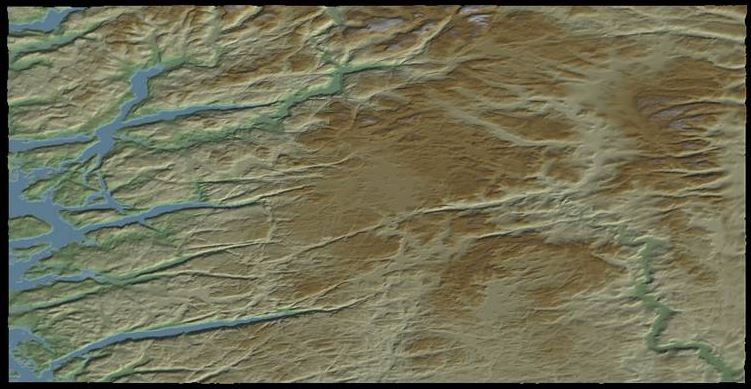
As it’s a part of Norway, the latitude is high and the terrain is highly deformed because of the projection.
The size of the terrain is 2123 x 1082 pixels.
Then I use a “Change terrain size” node to retrieve the good aspect ratio:
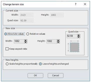
You need to:
- Uncheck the “Keep aspect ratio” check box
- Set the same value for width and height
- Set the same value for the quad size (30.86 meters for the “Precise” resolution (default value) and 92.59 meters for “Coarse” resolution).
- Select “Leave heights unchanged”
Here is the result:
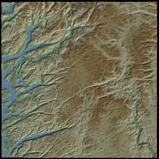
Et voilà!