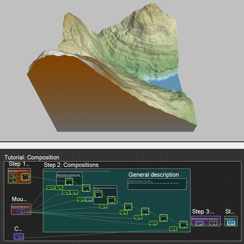
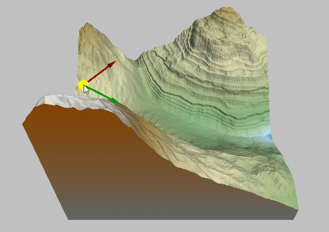
In this sample, we are going to use a powerful feature of Instant Terra: composition. Full composition nodes blend together different landforms to create a single, larger landscape. Each composition can be modified using a manipulator. Manipulators are 3D gizmos in the Viewport that you can click and drag to change quickly and easily the values in the Properties panel.
Select Help > Samples to access the sample project.
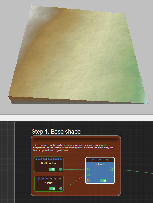
Step 1: Base shape
The base shape is the landscape, which we will use as a canvas for the composition. As we want to create a valley with mountains on either side, the base shape will have a gentle slope.
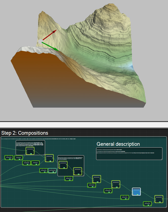
Step 2: Compositions
We will compose seven mountains and one crater in our terrain. Each of the mountains are transformed independently using scale, rotate, and translate transformations. Some of them are also affected by erosion or by a reshaping curve operation.
A Full composition node is an operator used to combine several landforms into a single landscape.
Note that to avoid visual artifacts, the landform must blend to 0 at its borders.
When selecting a Full composition node, a manipulator gizmo appears to allow you scale, rotate, and translate the landform intuitively. Click the right mouse button on a manipulator gizmo to toggle between scale, rotation, and translation.
Double-click on each Full composition node to undock the Properties panel. You can open and undock the Properties panel of the manipulator gizmos of more than one composition node.
A single import can be used several times in a project. Each part of the terrain can be transformed independently, for example, using a Scale or an Apply curve node. If the input file is changed, Instant Terra automatically reloads it and recomputes the entire graph.
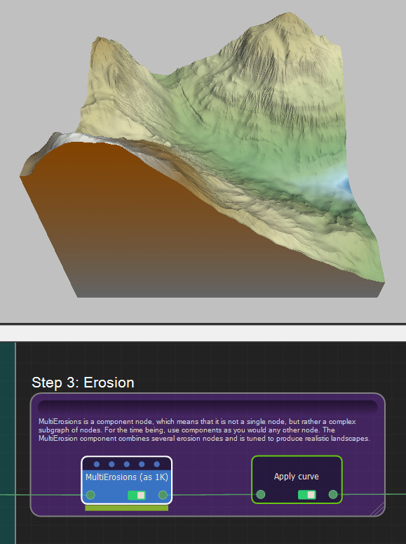
Step 3: Multi erosion
Multi erosion is a component node, which means that it is not a single node, but rather a complex subgraph of nodes. For the time being, use components as you would any other node. The multi erosion component combines several erosion nodes and is tuned to produce realistic landscapes.
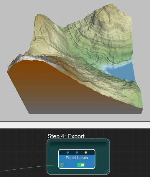
Step 4: Export
Lastly, export the terrain composition.