This sample demonstrates how you can use the Advanced Water level color node to create lakes at different levels.
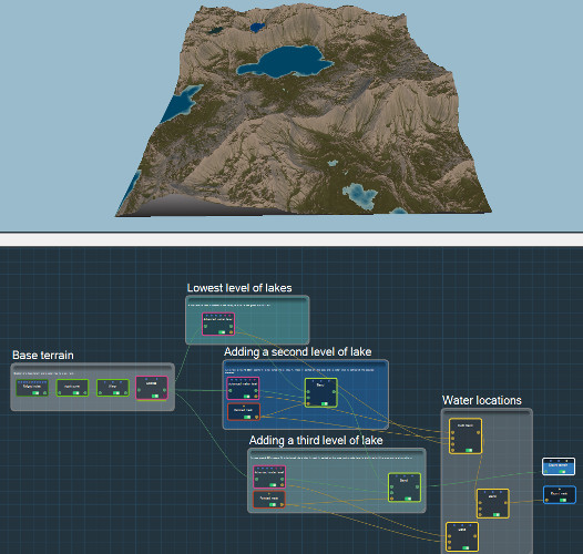
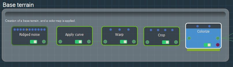
- Create a basic terrain with a color map. We simply used the default Instant Terra project. A color map is added using the Colorize node. Replace this basic terrain with your own terrain.
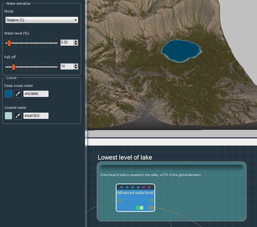
- Add a water layer in the valley. Here, we define the water elevation as a percentage of the total elevation of the terrain. No mask is applied, so water is added to all parts of the terrain with a lower elevation.
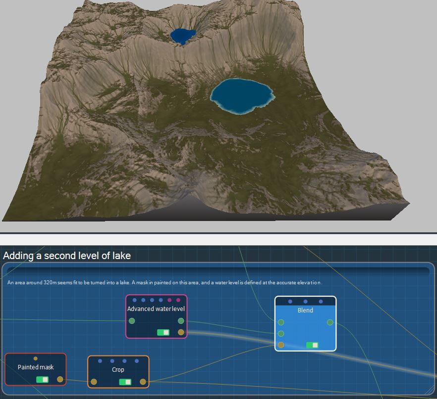
- Add an intermediate water level. An area around 320 m seems ideal to shelter a lake. We paint a mask on this area and add a water level around 320 m. The elevation of the water is adjusted according to the desired result. The blend with the previous result is done using the mask so that water is only added at this location.
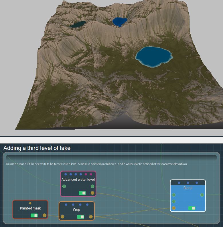
- Add a second water layer. We repeat the same operation on a water level around 340 m.
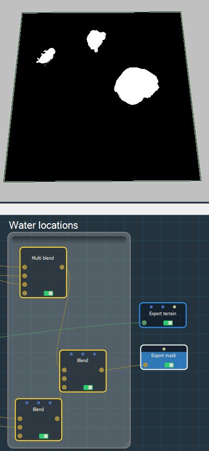
- Water locations for each level of water are blended together and the final mask can be exported.
Copyright © 2022 · All Rights Reserved · Wysilab