Adding a Mountain erosion node
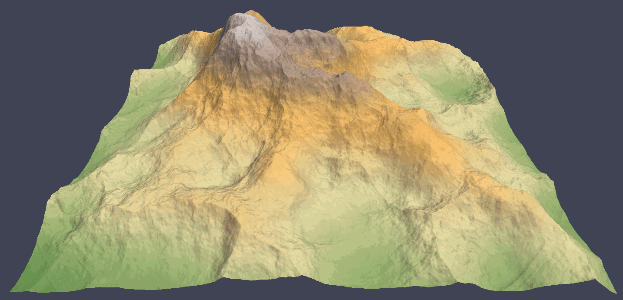
The mountain erosion node simulates the effect of fluvial erosion and rock weathering over a wide time span. The simulation produces results different from those of hydraulic erosion: more uniform carving on the slopes and less sedimentation. The user controls the strength of the erosion and the shape of the crevices that emerge.
To add a Mountain erosion node, right-click in the Graph Editor and select Create Node > Simulation > Mountain erosion.
This node only transforms an input terrain and does not output water or sediment layers.
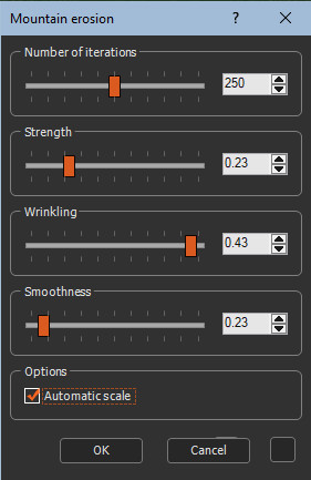
Double click on the node to open its parameters:
Editing a Mountain erosion node
Set the following parameters:
- Number of iterations: Sets the number of iterations.
- Strength: Sets the strength of the erosion.
- Wrinkling: Controls the appearance of rivers and crevices on the slopes of the mountain.
- Smoothness: Controls the shape of the slopes. If the smoothness is close to zero, the crevices will be deeper and the ridges will be rounded. If the smoothness is high, the slopes will be very smooth, as if each crevice is filled with sediment, and the crests will look sharp and pinched.
- Automatic scale: The result of the Mountain
erosion node has been optimized for a terrain whose quad size
(resolution) is equal to 1 meter. When the quad size is more than 1
meter or less than 1 meter, the node is more difficult to adjust
and may give inferior results. The Automatic scale option overcomes
this difficulty to obtain results of the same quality, whatever the
quad size.
The option is enabled by default. It is advisable to leave it enabled, except for users who are familiar with the various parameters of the erosion node.
Most of the parameters can be driven by a mask provided by the user.
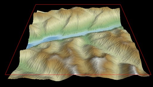
The tile being calculated is highlighted and surrounded by a red frame. This is only visible if the erosion parameters window is open.
Parameters
| Parameter | Description |
|---|---|
| Number of iterations | Sets the number of iterations |
| Strength | Sets the strength of the erosion |
| Wrinkling | Controls the appearance of rivers and crevices on the slopes of the mountain |
| Smoothness | Controls the shape of the slopes |
| Automatic scale: | Automatically scales the terrain so that the result has the same quality as a terrain with a quad size of 1 meter |
Some combinations of parameters may lead to a divergent simulation.
Copyright © 2022 · All Rights Reserved · Wysilab