This sample demonstrates the use of the hydraulic erosion simulation to create a realistic terrain, and carve and tweak a river.
See also Hydraulic erosion.
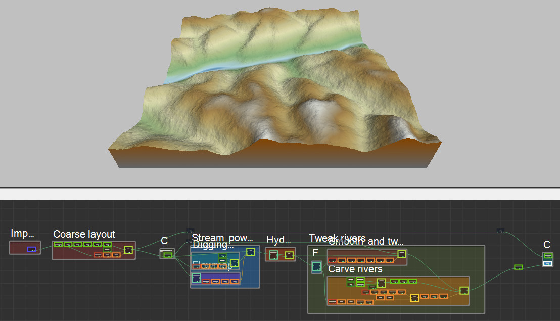
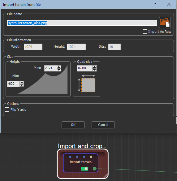
- The first step imports a terrain of 1024 x 1024 K and 16 quads terrain from a file.
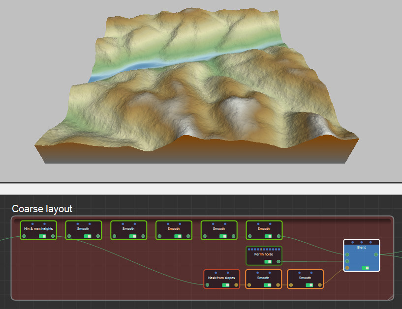
- The coarse layout of the terrain is created through a series of mask and terrain transformation nodes, a mask generation node and a terrain generation node, and the results are summed.
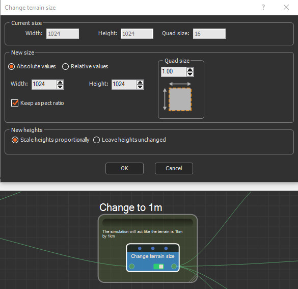
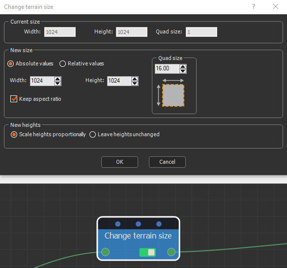
- The terrain quad size is decreased from 16 quads to 1 quads in the Change terrain size node. The simulation now acts as if the terrain is 1 km by 1 km.
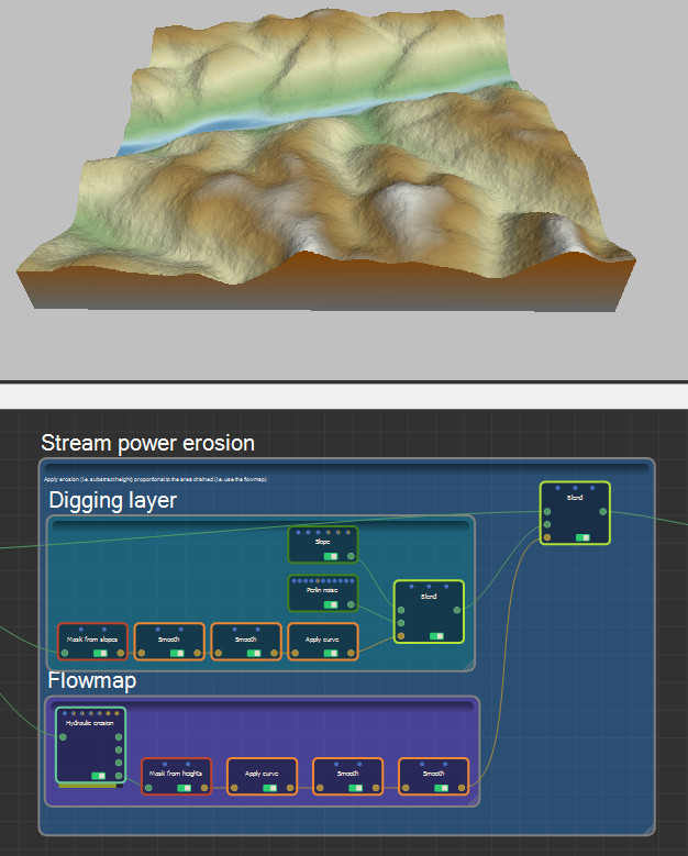
- The next step refines the terrain's erosion. It applies erosion (i.e. subtracts the heights) proportionally to the area drained, which is the flow map.
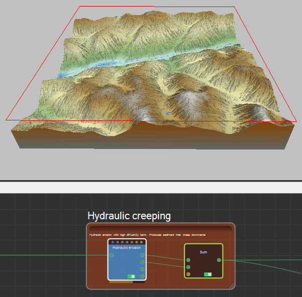
- Hydraulic erosion simulates the slow movement of sediment downhill.
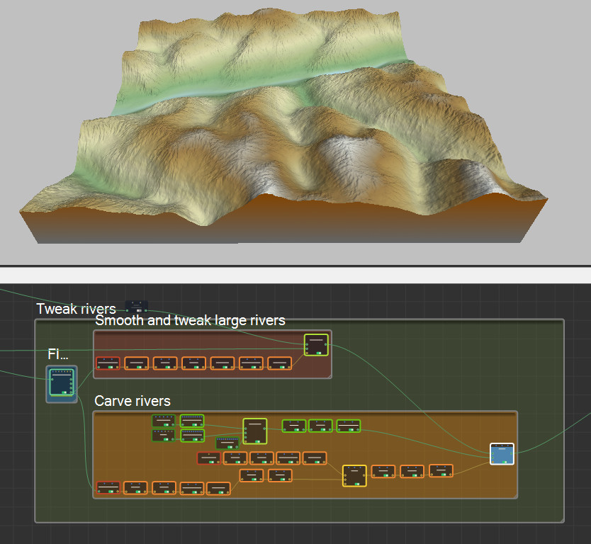
- The rivers are carved and smoothed by a series of simulation, and terrain and mask generation and transformation nodes.
- The terrain quad size is reset to the original size of 16 in the Change terrain size node.
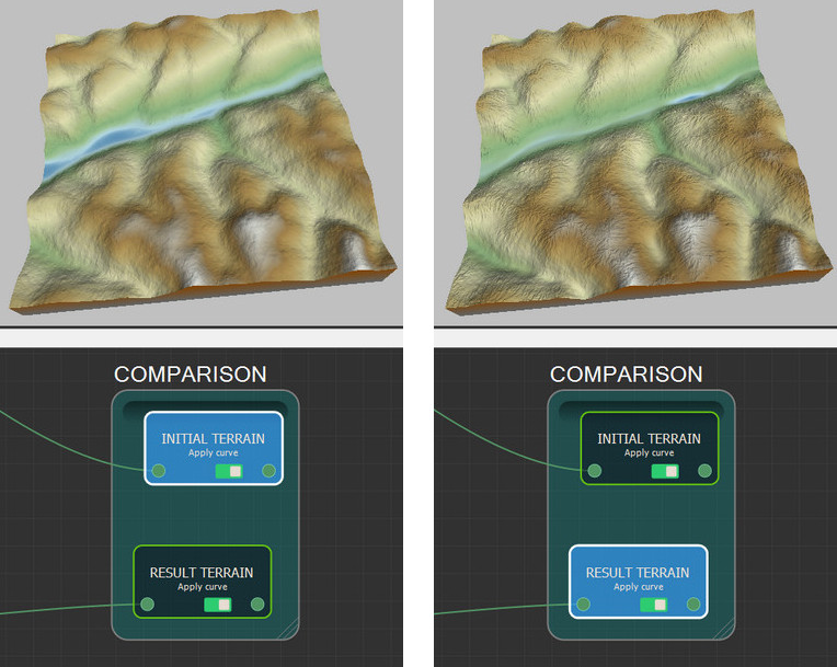
- Compare the original and the output terrains in the final two nodes.