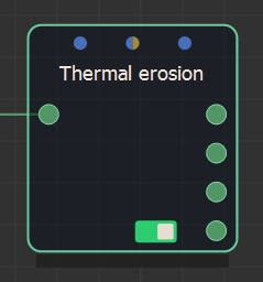
Adding a Thermal erosion node
The Thermal erosion node creates thermal erosion on a terrain. Thermal erosion is similar to hydraulic erosion, with the addition of the possibility that the banks of the rivers collapse, giving rise to wider rivers.
The node has four outputs:
- The eroded terrain
- The height of the sediment
- The depth of the water
- The cumulative water height
To add a Thermal erosion node, right-click in the Graph Editor and select Create Node > Simulation > Thermal erosion or press the keyboard shortcut NTE (Node Thermal Erosion).
Double click on the node to open its parameters:
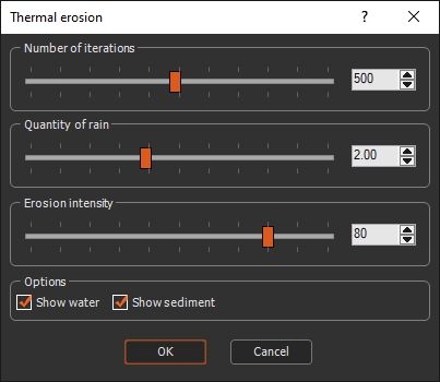
Editing a Thermal erosion node
Use the sliders to set the Thermal erosion parameters:
- Number of iterations: Sets the number of iterations.
- Quantity of rain: Quantity of falling water, in centimeters per second.
- Erosion intensity: Defines the strength of the erosion: the greater the value, the more the terrain will be eroded.
- Show water: This option is checked by default. Uncheck the option to view erosion without displaying any water on your terrain.
- Show sediment: This option is checked by default. Uncheck the option to view the node without displaying any sediment.
Example
Below is an example of thermal erosion on a terrain.
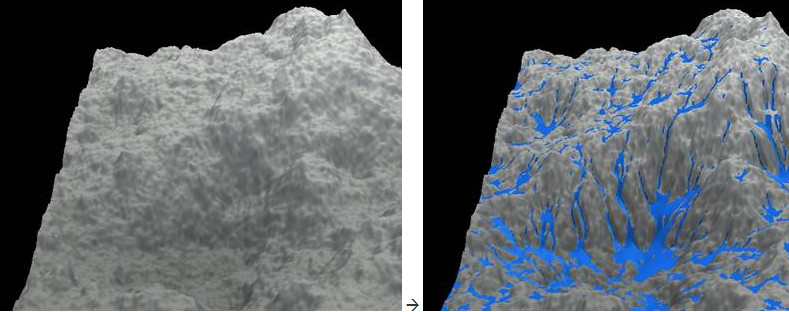
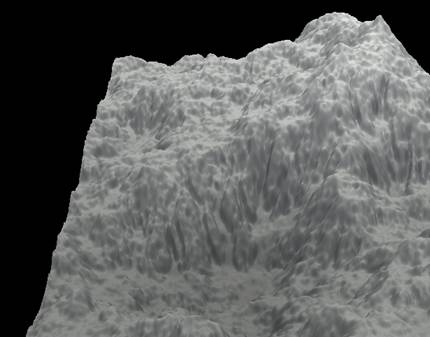
Here is the same result without the water display.
You can connect a mask to the Quantity of rain parameter to precisely define the places where erosion will take place.
Parameters
| Parameter | Description |
|---|---|
| Number of iterations | Sets the number of iterations. |
| Quantity of rain | Quantity of falling water, in centimeters per second. |
| Erosion intensity | Defines the strength of the erosion. |
| Show water | Shows any water on the terrain. |
| Show sediment | Shows any sediment on the terrain. |