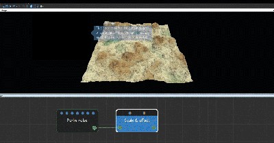
Adding a Scale & offset node
This node sets the scale and offset of the terrain. The node allows you to achieve wide variation by modifying the height of my terrain.
To add a Scale & offset node, right-click in the Graph Editor and select Create Node > Terrain Transformation > Scale & offset.
Double click on the node to open its parameters:
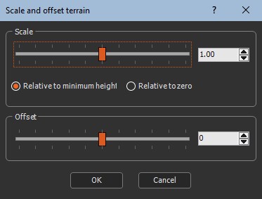
Editing the scale and offset
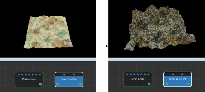
- Use the Scale slider to change the scale of the terrain size. This parameter, like the Min & max height node, modifies the height of each vertex of the terrain, but it uses a multiplying coefficient. Modifying the Scale parameter even slightly drastically changes the terrain relief.
- Set to what the scale is relative:
- Relative to minimum height: Minimum value of the terrain heights does not change. For example, if the terrain heights are between -20 and 80 (range 100), and with a factor of 2, the heights lie between -20 and 180 (range 200).
- Relative to zero: Zero heights do not change. For example, if the terrain heights are between -20 and 80 (range 100), and with a factor of 2, the heights lie between -40 and 160 (range 200).
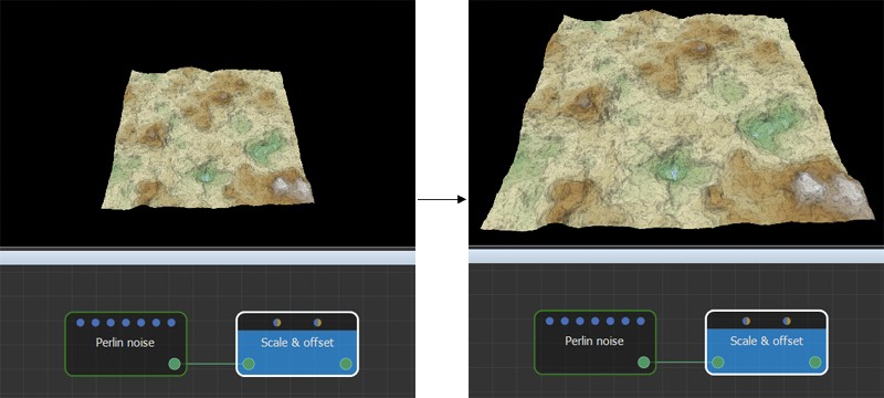
- Offset: Sets the positive or negative offset to apply to the terrain. This parameter repositions the entire terrain higher or lower than its initial position.
Parameters
| Parameter | Use |
|---|---|
| Scale | Scale factor to be applied. |
| Relative to minimum height | Minimum value of the terrain heights does not change. |
| Relative to zero | Zero heights do not change. |
| Offset | The positive or negative offset to apply. |