Adding a Transform terrain node
This node modifies the first terrain before it is inserted into a second terrain.
This node is quite similar to the Full composition node, except that its role is to modify a terrain and not to compose it with another one. Like the Full composition node, this node also has multiplying coefficients: one to manage the height of the input terrain and another to manage the area outside the terrain after rescaling the terrain or increasing the terrain size.
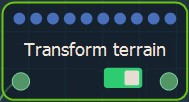
To add a Transform terrain node, right-click in the Graph Editor and select Create Node > Terrain Transformation > Transform terrain.

Double click on the node to open its parameters:

Editing a Transform terrain node
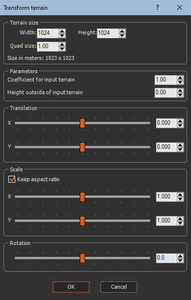
Edit the Transform terrain node in the parameters dialog:
- Terrain size: Sets the Width, Height, and Quad size of the terrain.

- Coefficient for the input terrain: Sets the coefficient by which the height of the input terrain is multiplied.

- Height outside of the input: Sets the height of the output terrain vertices around the input terrain if the output terrain is larger than the input terrain.

- Color outside input: When the input terrain is linked to a color map, this parameter is displayed; otherwise, it is hidden.
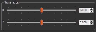
- Translation X and Y: Translates the input terrain along the X and Y axis. The translation values are relative to the output terrain size:

- 0 sets the center of the input terrain to the center of the output terrain.
- -1 sets the center of the input terrain to the left border of the output terrain.
- 1 sets the center of the input terrain to the right border of the output terrain.

- Scale X and Y: Scales the input terrain along
the X and Y axis.
Check Keep aspect ratio to scale along the X or Y scale preserve the relative horizontal and vertical sizes.Note that when the scale manipulator is displayed, it is no longer possible to select a single axis; both axes are selected at the same time.

- Rotation: Rotates the input terrain around its center from 0 to 180 degrees.


Parameters
| Parameter | Use |
|---|---|
| Terrain size | Sets the Width, Height, and Quad size of the terrain |
| Coefficient for the input terrain | Sets the coefficient by which the height of the input terrain is multiplied |
| Height outside of the input terrain | Sets the height of the output terrain vertices around the input terrain If the output terrain is smaller than the input terrain |
| Color outside input | When the input terrain is linked to a color map, this parameter is displayed; otherwise, it is hidden |
| Translation - X | Translates the input terrain along the X axis |
| Translation - Y | Translates the input terrain along the Y axis |
| Scale - X | Scales the input terrain along the X axis |
| Scale - Y | Scales the input terrain along the X axis |
| Rotation | Sets the angle in degrees used to rotate the input terrain around its center |
Copyright © 2022 · All Rights Reserved · Wysilab